Thursday 17 December 2020

Coldingham Priory

Coldingham Priory

The remains of Coldingham Priory are located in the village of Coldingham in the Scottish Borders. Little remains today except the arch and remains of the cloisters and other monastic buildings. In 1855 the ruins from he original priory church were used in the construction of a new parish church which sits on the site today.

The priory was built in 1098 but the site was in use long before then a a religious establishment. In 660AD it was recorded that Ethelrida, the Queen of Egfrid became a nun at the Abbey of Coldingham. The abbey was under the management of Aebbe the elder ( St Ebbe) and was described as the "monastery of virgins". At the same time Aebbe was also Abbess at the monastery on Kirk Hill at St Abb's Head, which housed both monks and nuns. In 697 after Aebbe's death, the abbey at Coldingham burnt down but was rebuilt. However, when the monastery on Kirk Hill burnt down it was not rebuilt and was abandoned. It is thought that nuns may have moved from  Kirk Hill to Coldingham and that a community of nuns may have resided at Coldingham in the 8th or 9th centuries. In 870 the abbey was destroyed by a party of Danes and this time it was not rebuilt.

In 1098 the site was rebuilt into a Benedictine Priory. It is these remains that can be seen today. The original church was damaged by King John of England and in 1216 work began on the construction of a new priory church. It is the arch from this church that remains today. In 1532 the English burned the priory and in 1560, at the time of the Scottish reformation it was partly destroyed. Eventually in 1650 the priory was almost totally destroyed by Cromwell's army and was never rebuilt. In about 1777 the remains of the great tower finally collapsed, but in 1855 about 40% of the original priory church was reconstructed and used in the new parish church which is built on the same site.


Remains Of Monastic Buildings

The New Parish Church And Remains Of The Old Priory


Other Priories Nearby

Friday 30 October 2020

Hethpool Linn


Hethpool Linn

Hethpool Linn is a beautiful waterfall situated in the Cheviot Hills within the Northumberland National Park. The waterfall forms part of the College Burn near Hethpool in the College Valley,  running through a small gorge and tumbling over rocks before continuing its journey peacefully along the valley floor. It is situated within a small wooded area of the valley close to the hamlet of Hethpool and is crossed via a small wooden bridge. When approaching the waterfall take care of the steep sides. The waterfall can be walked to on its own or part of a longer walk (Hethpool Linn Walk).


Other Waterfalls Nearby
 Linhope Spout
  Carey Burn Waterfall

Etal


Etal Village

The quaint village of Etal is situated in North Northumberland about 10 miles from Berwick-Upon-Tweed and not far from the battle fields of Flodden.  It lies peacefully on the banks of the River Till and is overlooked by the remains of Etal Castle. The Main Street is lined with picturesque cottages and a thatched pub. Opposite, the Lavender Tea Room serving excellent food is the perfect way to relax and indulge yourself. The castle overlooks the peaceful River Till where walks and picnics beside the river in this idyllic location are a wonderful way to spend the day.

Etal and the neighbouring village of Ford are part of the Ford and Etal Estate, owned by the Joicey Family since 1908. However, a settlement has existed at Etal since at least the 12th century when a manor or estate were granted to the Manners family by the Norman Barony of Wooler in return for military support when needed. The family built first a wooden hall, replacing it with a stone building before building a tower house in 1341 which was extended in 1360 to become the castle, whose remains are seen today. In 1748 the owners moved from the Tower house in the castle to Etal Manor at the other end of the village. 

Etal became a busy village with ferry services across the river and nearby water mills. In the 1700's Etal Colliery was opened about one and half miles to the northeast of the village along with other smaller local mines. By the early 20th century these has all closed and the village was purchased by the 1st Baron Joicey of Chester-Le-Street, creating the Ford and Etal Estate.  


River Till


Etal Castle
Etal Castle was built about 1341 by Robert Manners to defend Etal against the Scots. The Manners family had lived in the village since 1232 and the castle remained in the family until the end of the 15th century when the current owner, George Manners moved his family away and abandoned the castle. During the border wars with Scotland the castle housed a garrison and was used to defend the area. In 1547 the castle was bought from the Manners family by The Crown and in 1603 passed into private ownership. In the 18th century it ceased to be used as a residence and fell into ruin.

The castle is open to the public and is a fascinating insight into life at the castle during the turbulent border wars.


Etal Castle
 
Etal Castle

St Mary The Virgin Church
The first church in Etal was built by Sir Robert manners in 1345 and was located on the banks of the river  a little downstream from the village. By the early 19th century it had fallen into decay. In 1856 the chapel of St Mary the Virgin was built and consecrated for worship in 1859.

St Mary the Virgin is a small Victorian chapel situated just inside the grounds of Etal Manor. It was built to honour the husband and daughter of Lady Fitzclarence of Etal Manor, who died within two years of each other and to house the family tomb. In 1971 the chapel ceased to be a private chapel and became part of the Ford parish. 


Friday 25 September 2020

River Tweed At West Ord


West Ord is a small area on the south bank of the the River Tweed. It is about four miles from Berwick-Upon-Tweed and not far from the village of Horncliffe and the Union Chain Bridge. This small area is largely farmland with a few holiday cottages, however a small road loops from a small road near to the junction with the A698 along the banks of the river to the hamlet of Loanend. 

This serene and unspoilt spot offers fantastic views across the river. On the opposite bank are some attractive fishing shiels close to the grounds of Paxton House. Approaching from the holiday cottages at the top of the hill are breathtaking views of the river valley and countryside opposite.  At the foot of the hill is a parking spot on the grass beside the sheep and the river, the perfect place to picnic or to embark on a picturesque riverside walk. This hidden gem is a truly beautiful, tranquil haven.


Thursday 24 September 2020

Chirnside


Chirnside is a large hillside village in the Scottish Borders. It is situated on the A6105 about seven miles east of the market town of Duns, nine miles from Berwick-Upon-Tweed and only a mile and a half from the small village of Allanton. The village has stunning views over the Tweed Valley with the Cheviot Hills in the distance. A short distance from the village is the picturesque Bluestone Ford and Whiteader Water

The village name is derived from the Cairn which stood on the hill to the east of the village. Close to the church a tower house once stood, built by the Earl of Dunbar. This was demolished in the 18th century. The first paper mill at Chirnside Bridge dats back to 1827, although all that now remains is the old porters lodge. In 1842 the mill was reconstructed and enlarged. During the 19th century the demand for fine paper increased and the mill continued to grow. As the mill grew the village increase in size, becoming a thriving community. 

View Over The Tweed Valley

Chirnside Church


Chirnside Church
Chirnside church dates back to the 12th century, but has been substantially rebuilt and altered. All that remains of the original Norman church is a doorway at the west end. The 12th century church, known as "Ecclesia de Chirnyside was a rectangular building with a thatched roof and earthen floor. 

During the Reformation in the 1500's the church was badly damaged and extensive repairs were carried out in 1573. In 1757 substantial renovations were carried out and a new manse built. In 1904 the church was altered and reshaped by Edward Marjoribanks, a new hall, vestry and new tower were built. 

Chirnside Church

Chirnside Bridge and The Whiteadder Water
Just outside Chirnside on the A6105 to Duns is the small settlement of Chirnsidebridge where the Whiteadder Water flows under the modern road bridge on its way from Preston and Blanerne to Allanton. Beside the river is the Paper Mill and Chirnside Bridge, a disused railway viaduct.


Monday 21 September 2020

Preston, Edrom And The Whitadder Water Cycle


This is a long but rewarding circular cycle from Paxton to the villages of Preston and Edrom, crossing the beautiful Whiteadder Water several times. This cycle is about 28 miles and will take just over 2hrs.

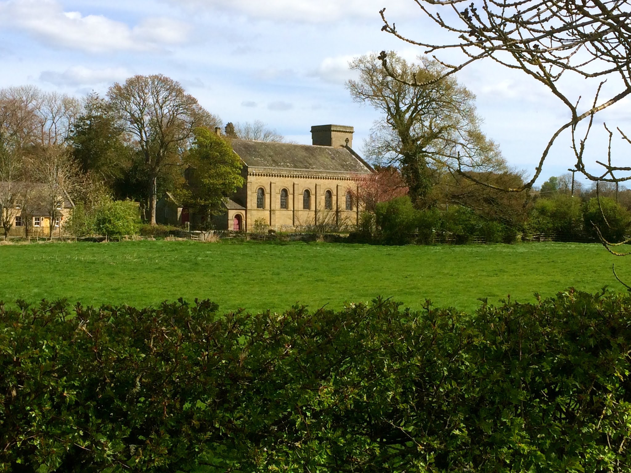
1. Starting from The Cross Inn head out of the village passing the church on your right. Turn left after the church and at the end of this road turn right  onto the B6460 in the direction of Greenlaw.

The Cross Inn, Paxton


Paxton Church


2. Proceed along this road for about 5 miles before taking a right turning towards Allanton and Chirnside. Cycle along this road, down the hill and through the village of Allanton. Continue over Allanton Bridge and up a long hill before eventually arriving at Chirnside and the junction with the A6105.

Allanton


Allanton Bridge

3. Turn left onto the A6105 in the direction of Duns. Continue along this road for a while towards Duns and Greenlaw until you reach a farm and mains. At the farm is a turning on the right to Cranshaws on the B6355. NOTE: There is a signpost by the farm but the actual turning in not signposted. Turn right and proceed along this country road for about 4.5 miles, passing agricultural fields and views of the Whiteadder Water before arriving in the village of Preston.

4. Turn right towards Duns, travelling through the village and passing the war memorial on your right and the village hall on the left. As you leave the village you will see a row of white cottages on the left and on a small hill to the right is an old parish graveyard.


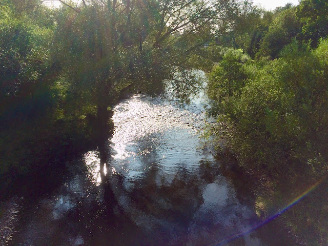
5. Just past the graveyard the road bends to the left and over The Whiteadder Water via Preston Bridge. There is a small parking are on the left and it is worth stopping and walking down to the banks of the river, where on one side of the bridge the water tumbles over the rocky river bed and on the other side flows calmly on its way towards Chirnside. 


View From The Bridge

6. Cycle over the bridge and carry on the A6112 for a while before ascending a steep hill. After the hill take a left hand turning, not signposted down a small country lane. Proceed down this small road passing some cottages on the left until you reach a junction. Turn left towards Chirinside and continue along this road, round a sharp right bend( do not turn left) and on towards a farm and some cottages. Turn right and continue along this small road before travelling uphill and turning sharply to the left at the top. 

(If you have time turn right instead into the village of Buxley and turn left through the gates of Manderston House. This beautiful house and gardens are well worth a visit).

7. Proceed along this road for some time before reaching the village of Edrom. At the junction turn left and continue on this road thought the village and back out into the country. Continue along this road to the hamlet of Blanerne. Do not take a road on the right but continue over the Whiteadder Water, past some houses, up a small hill and on until you reach a junction with the B6355.

Whiteadder Water At Blanerne

8. Turn right heading back to Chirnside. At the junction with the A6105 turn left towards Berwick-Upon-Tweed and continue back through Chirnside turning right at The Waterloo Arms onto the B6437. Carry on this road, down the hill and over the Whiteadder Water and through the village of Allanton. Proceed uphill through the village and continue before turning left towards Broomdykes. 

Whiteadder Water From Allanton Bridge

9. After passing through Broomdykes Farm and some brightly coloured cottages on the right you will arrive at a T junction. Turn left and head down a steep hill, passing an egg farm on the left. At the bottom follow the road as it curves to the right and continue uphill passing a farm and cottages on the left and an excellent farm shop on the right. Proceed along this road passing a cemetery on the right before arriving in the village of Hutton.

(NOTE. If you turn left at the bottom of the hill this will take you downhill to the beatuful and peaceful Blueststone Ford across the Whiteadder Water).


10.The road bends to the right before approaching a junction. Turn left and start heading back towards Paxton. Continue along this road, passing  Clarabad Farm before eventually travelling downhill to arrive back in Paxton Village.